What I learned
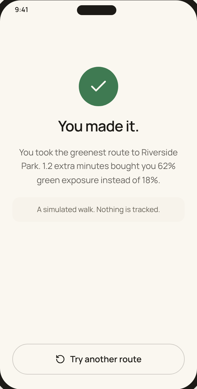
A small, honest number beats a big promise. Showing “1.2 more minutes for 62% green exposure” lets people make the call themselves.
Capping the detour at 15% kept the greener option realistic instead of turning it into a scenic tour.
Spatial Analysis + Product Design · Columbia GSAPP Computational Modeling
Course project, advised by Luc Wilson and Meli Harvey
The shortest way isn't always the best one. I built a green exposure metric from NYC Parks data, then turned it into a walking app that shows what a route feels like, not just how long it takes.
A route-scoring pipeline in Rhino and Grasshopper, plus a mobile flow for setting a detour limit, comparing a shortest, balanced and greenest route, and walking it turn by turn.
Someone walking somewhere on a hot afternoon wants to know if a slightly longer route would be calmer and shadier, and exactly how much time it would cost them.
Tools: Rhino, Grasshopper, NYC Parks Open Data, Claude Design
01 · A quick walk check
We spend a lot of time deciding where to go. We rarely think about how we want to feel on the way there.
Question 1 of 2
Pick the thing that makes you say “nope, I'm taking the subway.”
Choose one to continue.
02 · The problem is real
US adults
36%
named hot or humid conditions as a reason they don't walk to places within 10 minutes of home.
CDC, Preventing Chronic Disease (2025), 2022 SummerStyles survey of 3,967 adultsOn average
1.6°C
cooler in urban forests than in non-green urban areas, across a review of 308 studies.
US EPA, Benefits of Trees and VegetationThese are outside research findings, not results from the quiz above. A greener route won't be 1.6°C cooler every time.
03 · Why I care
My father is severely sensitive to sunlight, and I don't enjoy direct sun either.
That made me question something I had always taken for granted. Why does navigation treat the fastest route as the default, when the most comfortable route can be a completely different one?
04 · The design question
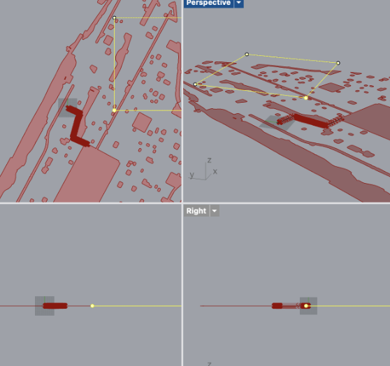
Navigation tools optimize for distance and time. I wanted environmental quality to count as a performance metric too, so I started with one data layer: green space from NYC Parks open data. A park only matters to a walker if the route actually brings them close to it.
The metric
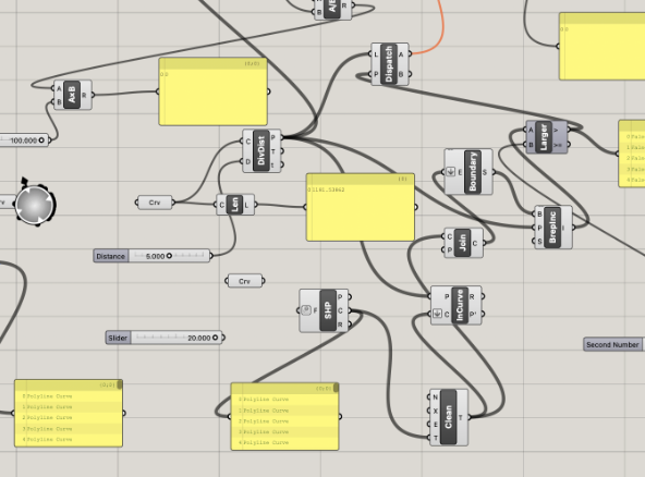
Green exposure = green-adjacent points ÷ total route points × 100
Divide Distance
Sample the walking route into evenly spaced points.
Pull Point
Measure each point's nearest distance to mapped green space.
Threshold
Mark points within 20 m as green-adjacent.
Dispatch
Split green-adjacent points from the rest and count both.
05 · Comparing routes
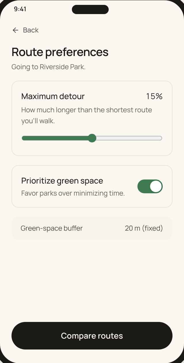
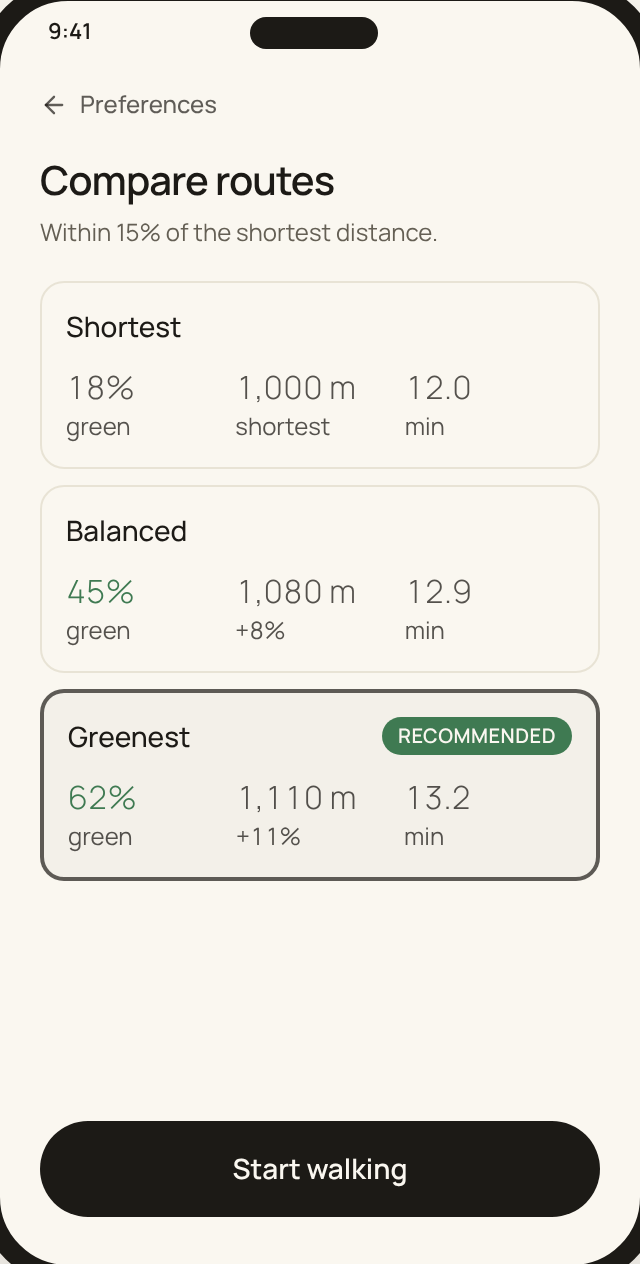
I scored three walking routes to Riverside Park. Any route had to stay within 15% of the shortest distance, so a greener walk never turns into a long one.
Green exposure
62%
of the route within 20 m of mapped green space
Detour vs. the 15% cap
+11%
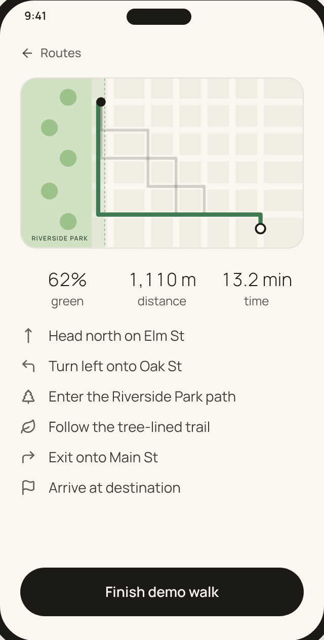
Numbers come from the Grasshopper analysis of one trip to Riverside Park. The map is a schematic, not to scale.
06 · Try the product
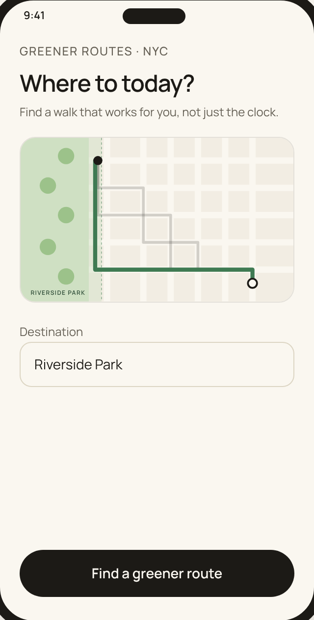
Enter a destination, set how far you're willing to detour, compare the routes that fit, and start a simulated walk. Try lowering the detour limit and watch the greenest route drop out.
Product decision
Put the time-versus-experience tradeoff at the moment of route selection, where people actually decide.
Research hypothesis
People understand the value of a greener route better when they see it right next to the ETA.
Scope
Every interaction works. The map is a schematic and the numbers come from one analyzed trip.
Greener routes · NYC
Find a walk that works for you, not just the clock.
07 · Final designs
Every step of the prototype above, start to finish. Each screen keeps the tradeoff visible: how much green you gain, and what it costs in minutes.
Reflection
A small, honest number beats a big promise. Showing “1.2 more minutes for 62% green exposure” lets people make the call themselves.
Capping the detour at 15% kept the greener option realistic instead of turning it into a scenic tour.
Technical: how can I generate and compare many valid routes automatically instead of drawing each one by hand?
Conceptual: is being within 20 m of a park a fair measure of how much nature a walker actually experiences? Green space is not the same as shade.
Add more data layers, like tree canopy and heat, so the score reflects comfort and not just proximity.
Test the flow with people who avoid the sun, and see whether they actually pick the greener route.
Continue
View all projects